Maps
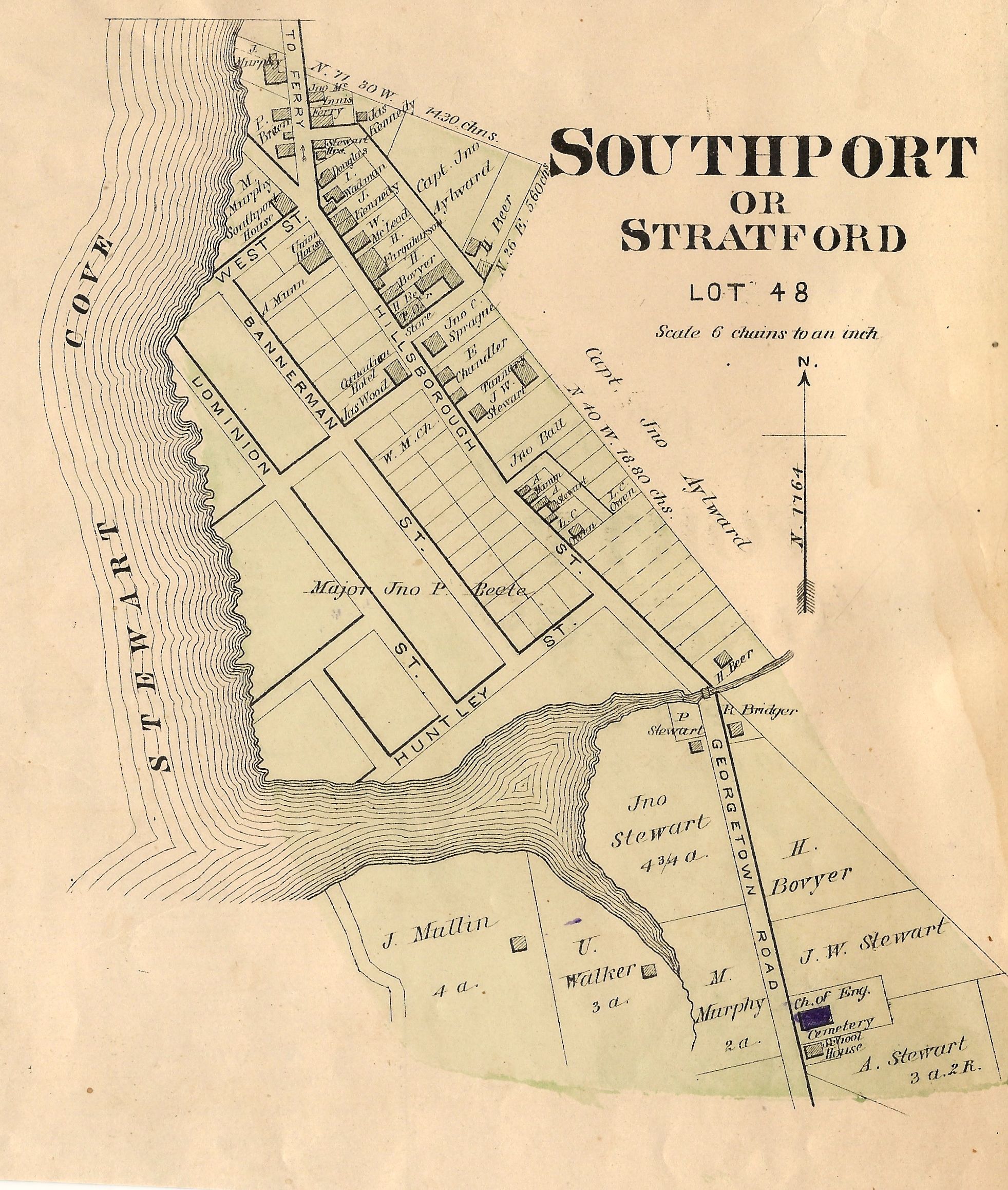
Southport (1880)

Southport (1880)
Title: Southport or Stratford, Lot 48
Size: 7 1/2 x 6 1/2"
Description: The map was liberated from an original copy of the Illustrated Historical Atlas of the Province of Prince Edward Island published by the J. H. Meacham in 1880. The map is based on surveys made under the direction of C. R. Allen, C.E. The image appearing in the listing is for reference only. At any given time, Gallery 18 will usually have multiple copies of the inset map available. The condition of each map will vary.
Published in 1880 by the J. H. Meacham Company, the Illustrated Historical Atlas of the Province of Prince Edward Island contains maps of each Lot on the Island, maps of Charlottetown and various towns and villages, and engravings of prominent citizens, properties and businesses. The maps are based on surveys made under the direction of C. R. Allen, C.E.
Included in this atlas is a Historical Sketch of the Province of Prince Edward Island and a Patron's Directory. The Historical Sketch covers the history of the Island from the first settlements and treaties to governance and Confederation. The Patron's Directory, located at the back of the atlas, gives biographical information about principal businessmen and professionals across the Island. This directory includes information such as their profession, nativity, and date of settlement.