Maps
Prince Edward Island (1775)
Prince Edward Island (1775)
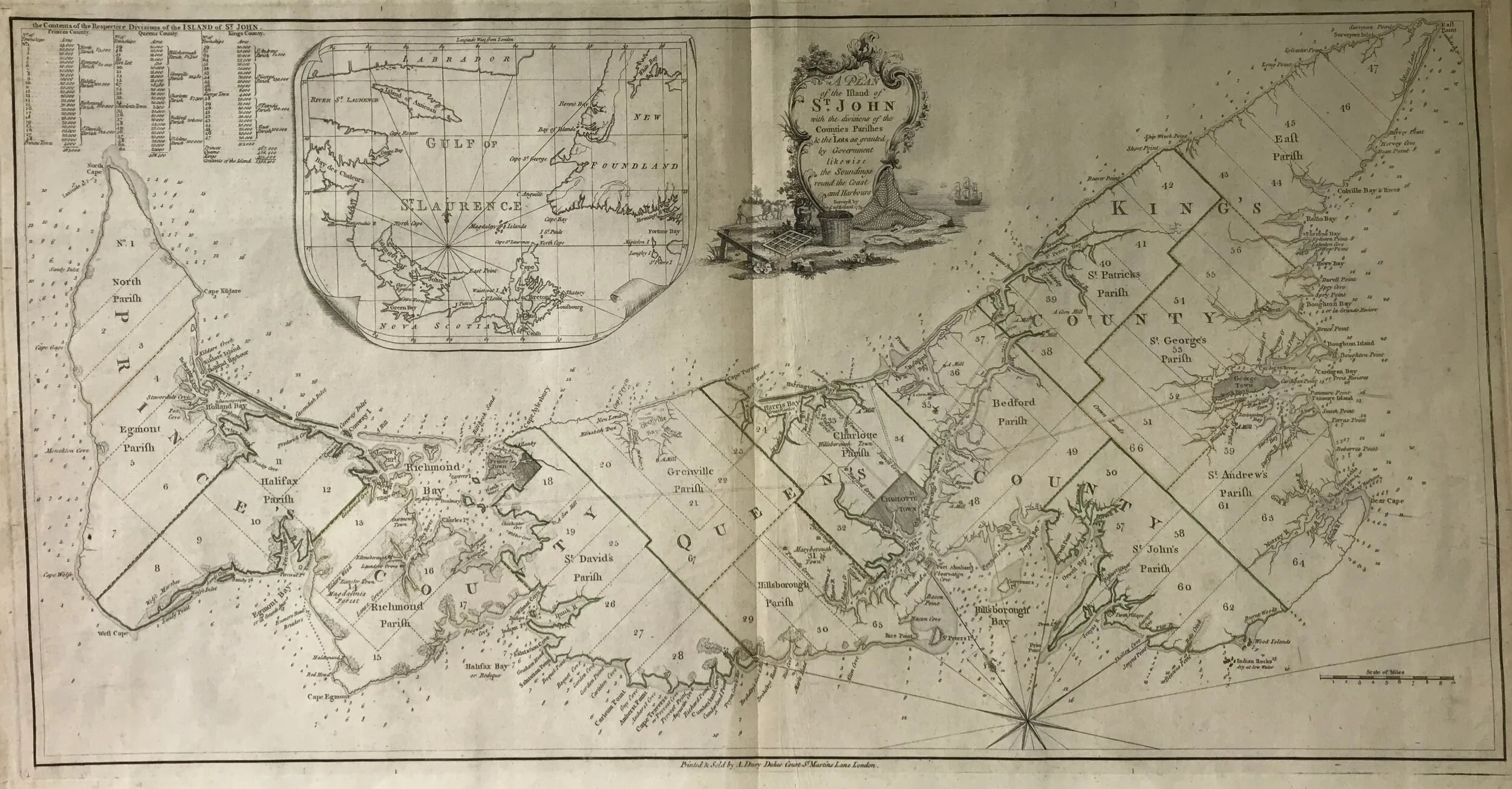
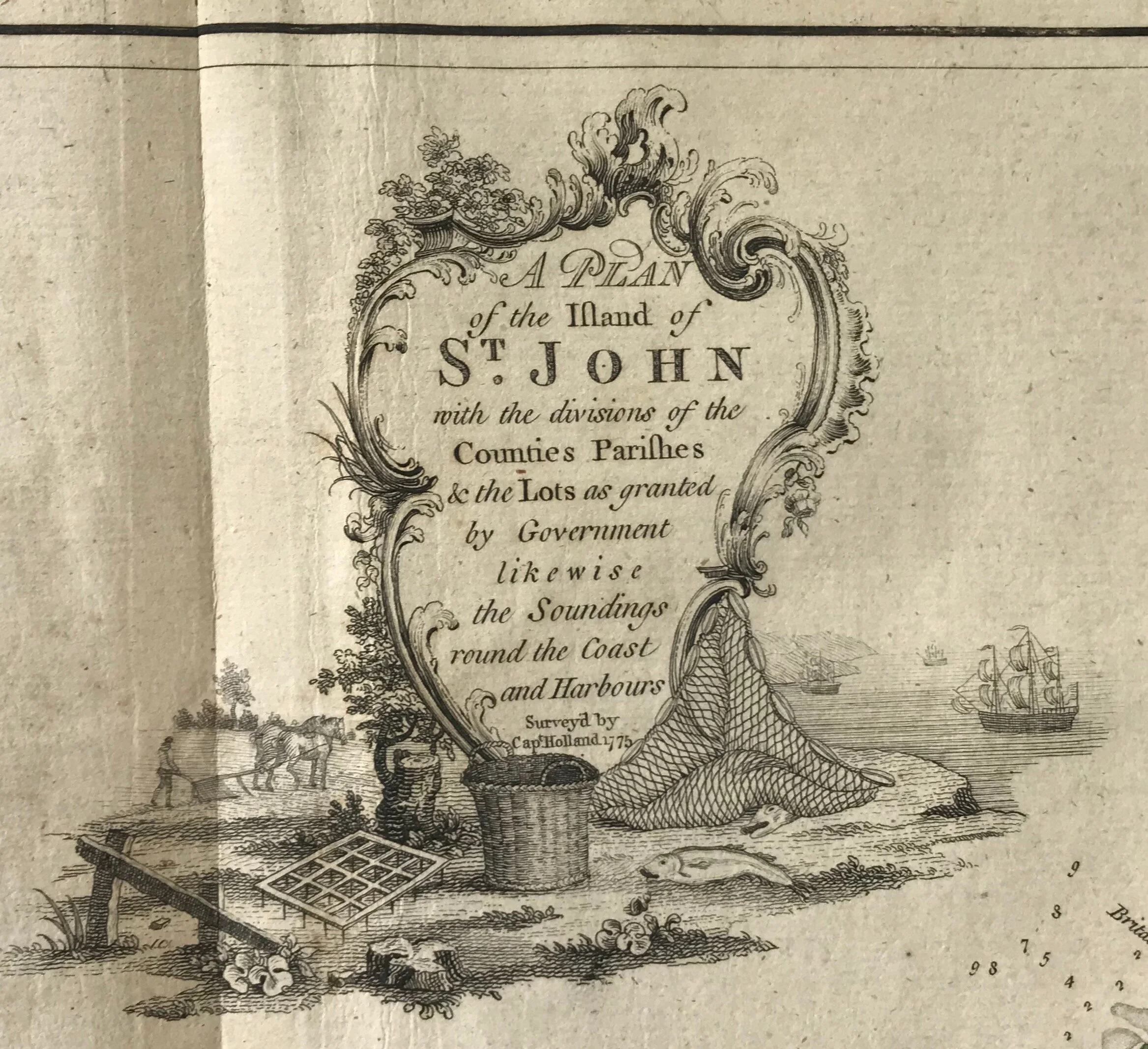
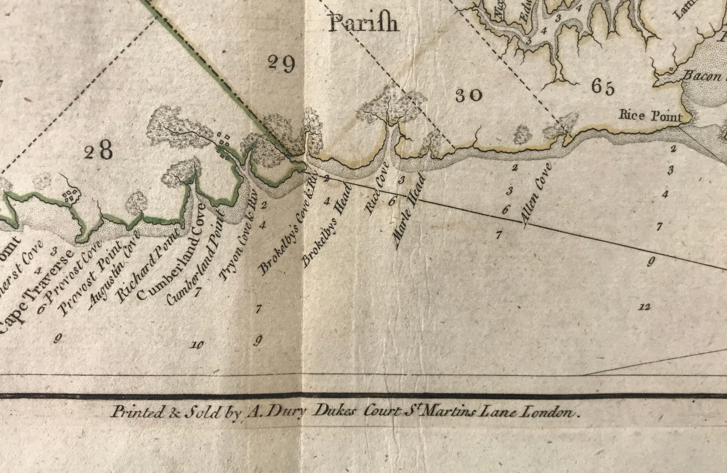
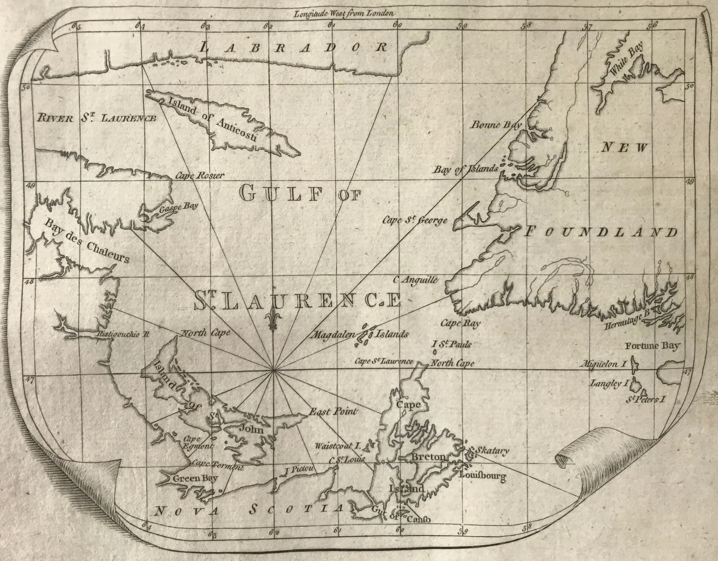
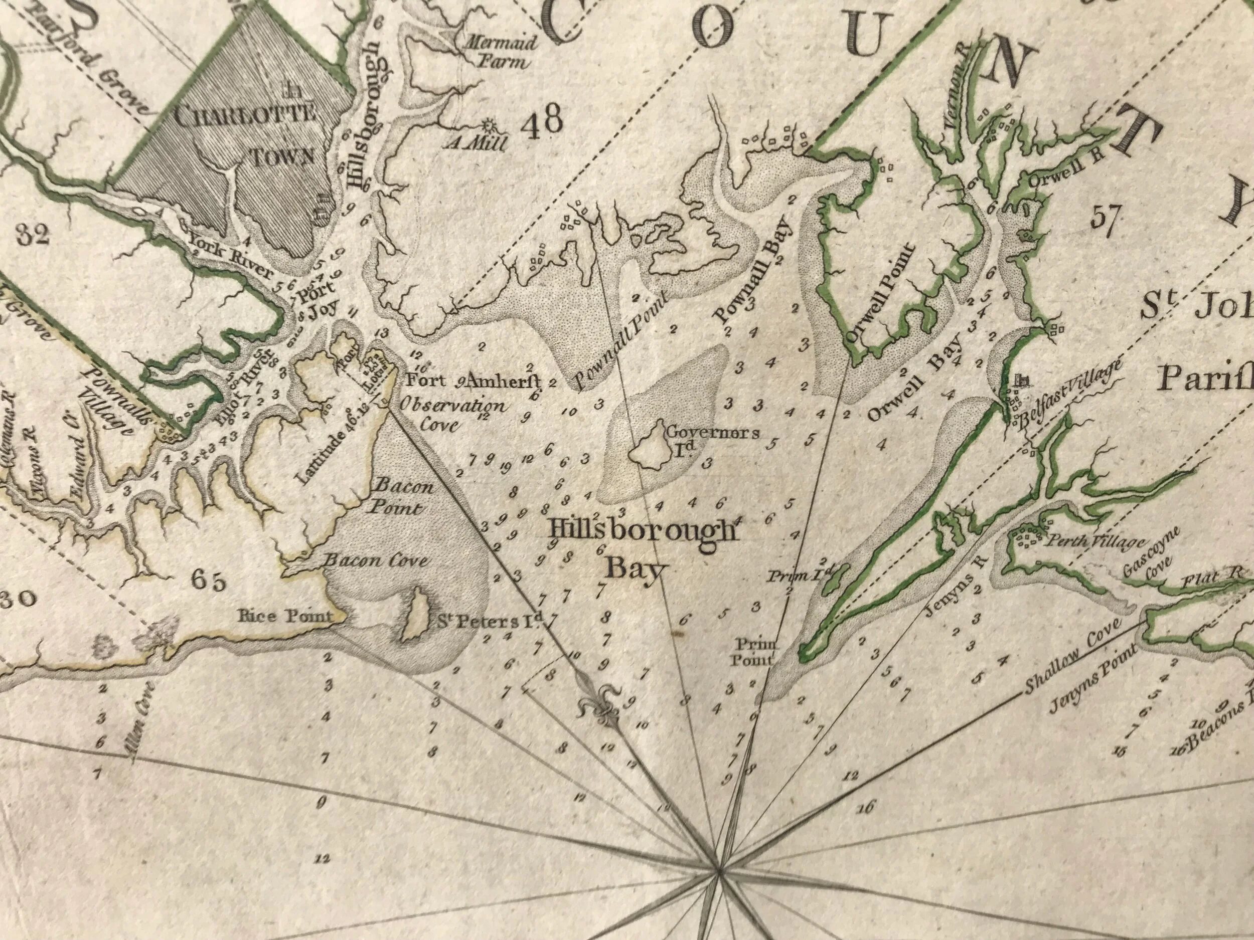
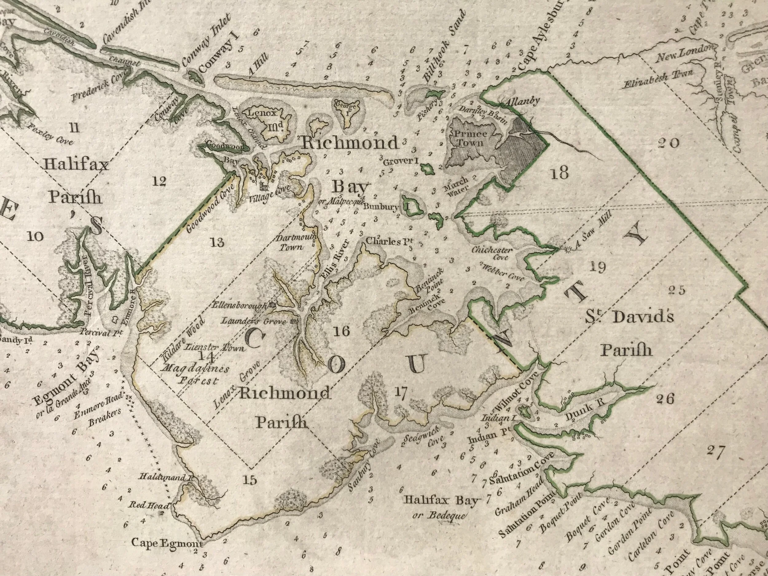
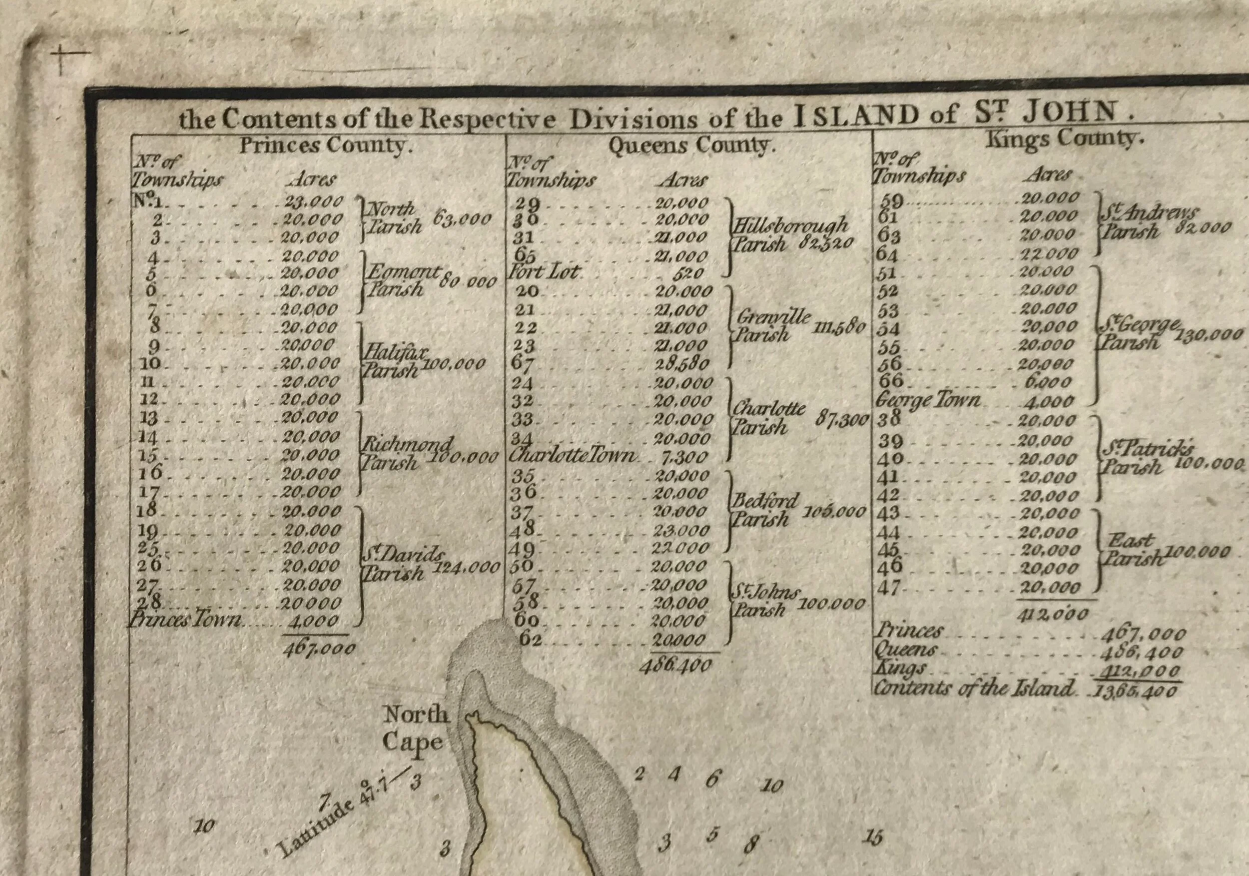
Title: A Plan of the Island of St. John with the divisions of the Counties, Parishes, and the Lots as granted by Government likewise the Soundings round the Coast and Harbours. Surveyed by Cap. (Samuel) Holland, 1775.
Publisher: Andrew Dury, London: c1775
Image size: 37 x 71 cm
Description: Copper engraving hand-colored in the outline. Depths shown by soundings. Oriented with north toward the upper left. Includes table of administrative divisions and inset of "Gulf of St. Lawrence," thus orienting the island in the gulf relative to the other Atlantic provinces. Matted and framed under glass.
Samuel Johannes Holland (1728-1801) was an army officer, military engineer, surveyor, office holder, politician, and landowner. He was born in Nijmegen, Netherlands, and died at Quebec, Lower Canada. In 1762, Samuel Holland submitted a proposal to the Board of Trade in London for a survey of all British possessions in North America in order to facilitate settlement. It was finally accepted in February 1764. with St John’s (Prince Edward) Island, the Îles de la Madeleine, and Cape Breton Island because of their importance for the fisheries. Holland left for St John’s Island, where he arrived early in October, 1764. Armed with a wide range of scientific instruments and assisted by the deputy surveyor, Thomas Wright, and a number of engineer officers, volunteer apprentices, non-commissioned officers, and privates, Holland conducted his survey of St John’s Island under harsh climatic conditions. He divided it into counties of approximately 500,000 acres, parishes of around 100,000 acres, and townships of about 20,000 acres, surveying them with precision by fixing latitudes and longitudes from astronomical observation; he also took careful soundings in coastal waters. On maps and in accompanying reports he recorded the principal rivers and harbours, and established the sites of projected towns, including the capital, which he named Charlottetown. He analysed possible land uses around these sites, providing a detailed account of forest resources, plant life, and the quality and extent of the soils, as well as an assessment of the climate, particularly for agriculture. By October 1765 he was able to send the first of his maps and reports to England, where they renewed an interest in land speculation that had manifested itself the previous year. When the Island was apportioned by lottery in 1767, Holland received Lot 28. That year he sent a few farmers and disbanded soldiers to settle it, and by 1798 there were 136 people living there. As an absentee landlord, Holland collected little rent from the tenant farmers during his lifetime. In Prince Edward Island, Holland is remembered as a founder of the colony and revered by some as an ancestor, his son John Frederick (and from about 1802 his widow, Marie-Joseph) having taken up residence there.
Source: Dictionary of Canadian Biography
Andrew Dury was a British map and print publisher in London. He was active in the 3rd quarter of the 18th-century.