Maps
PEI Map (1834)

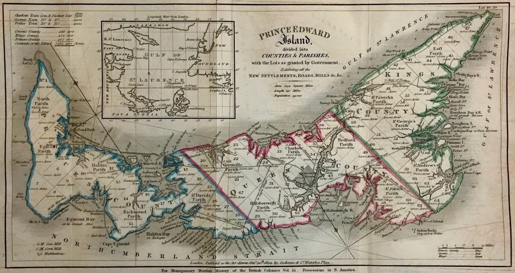

PEI Map (1834)
Title: Prince Edward Island divided into Counties & Parishes with the Lots as granted by Government.
Publisher: Cochrane & Co., London: 1834
Image size: 7 1/4” x 13 3/4” (18.4 x 34.9 cm) to outer neat line
Page size: 8 7/8” x 16 7/8” (22.5 x 42.9 cm)
Description: Copper-plate engraving with outline hand-coloring. Three vertical folds, as issued. Liberated from a volume of the History of the British Colonies (Vol. III) by R. Montgomery Martin, published by James Cochrane and Co., London. Shows minor age toning, off-setting, separation on folds, and small area of paper loss in margin - not affecting printed image.
Robert Montgomery Martin (c. 1801–1868), commonly referred to as "Montgomery Martin", was an Anglo-Irish author and civil servant. He served as Colonial Treasurer of Hong Kong from 1844 to 1845. He was a founding member of the Statistical Society of London (1834), the Colonial Society (1837), and the East India Association (1867).
Source: Wikipedia