Maps
P.E.I. Atlas (c1928)
P.E.I. Atlas (c1928)
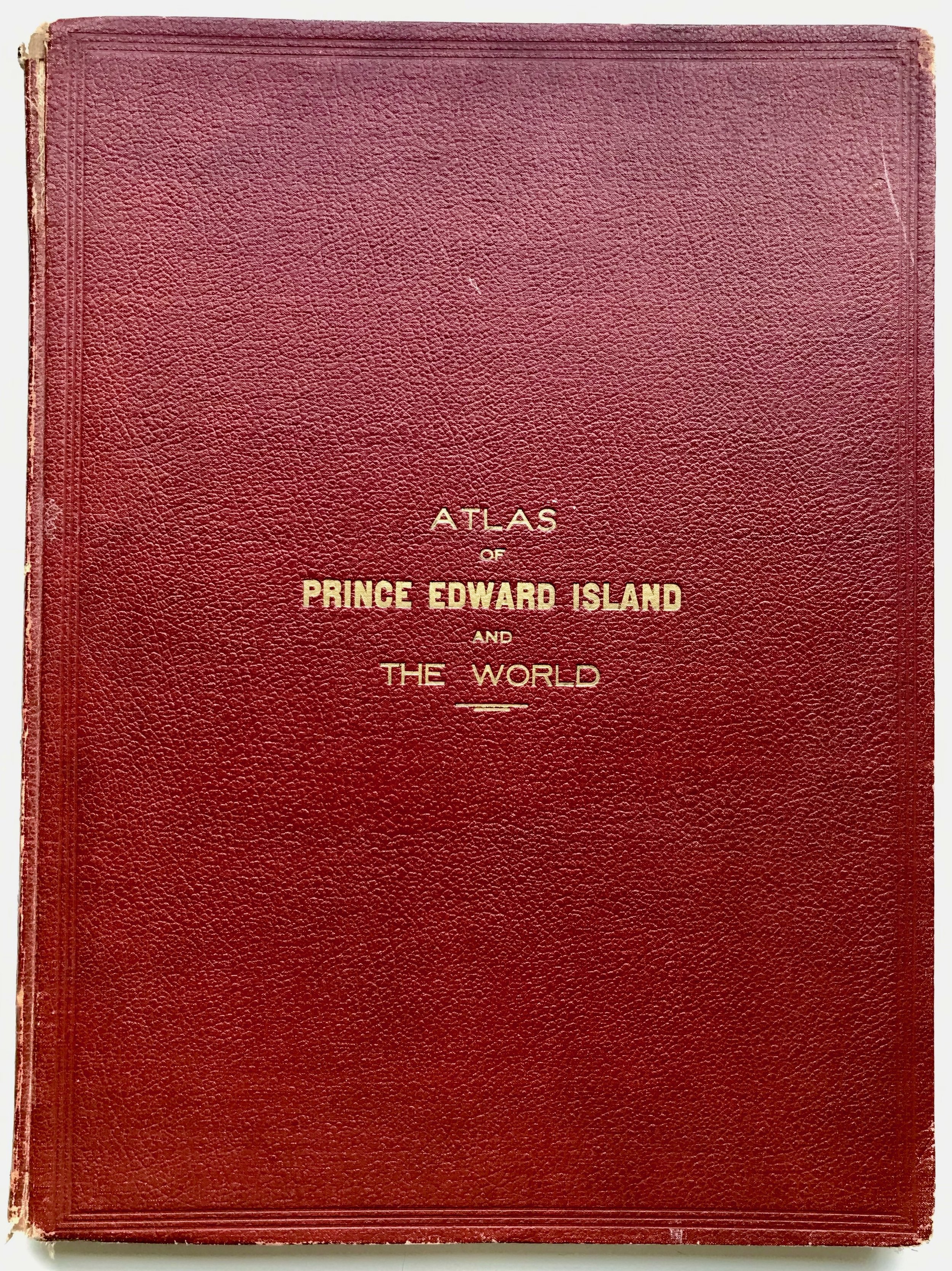
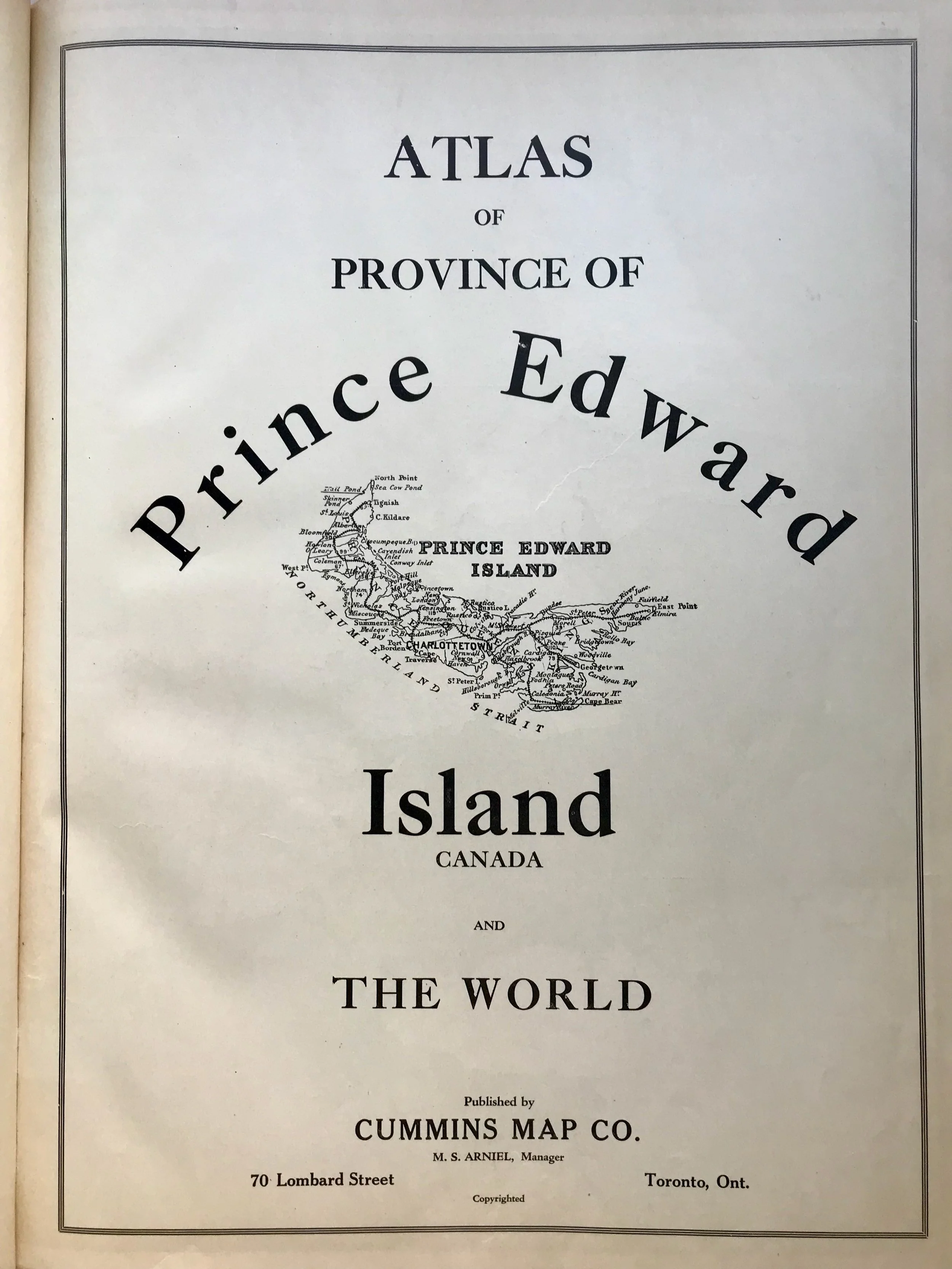
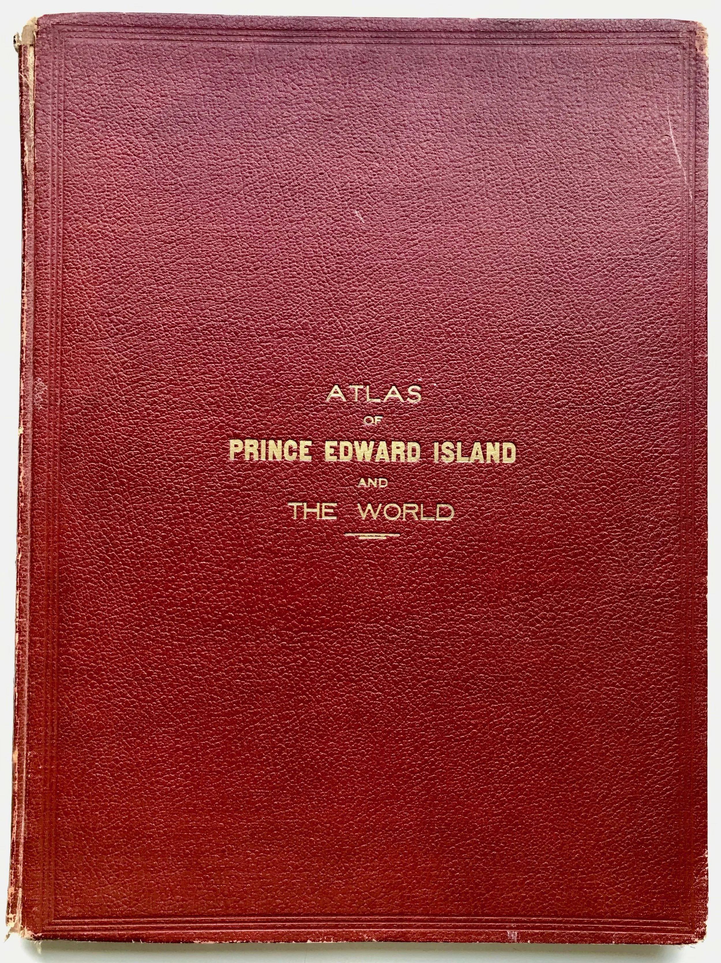
Title: Atlas of the Province of Prince Edward Island, Canada, and the World
Publisher: Cummins Map Co., Toronto: c1928
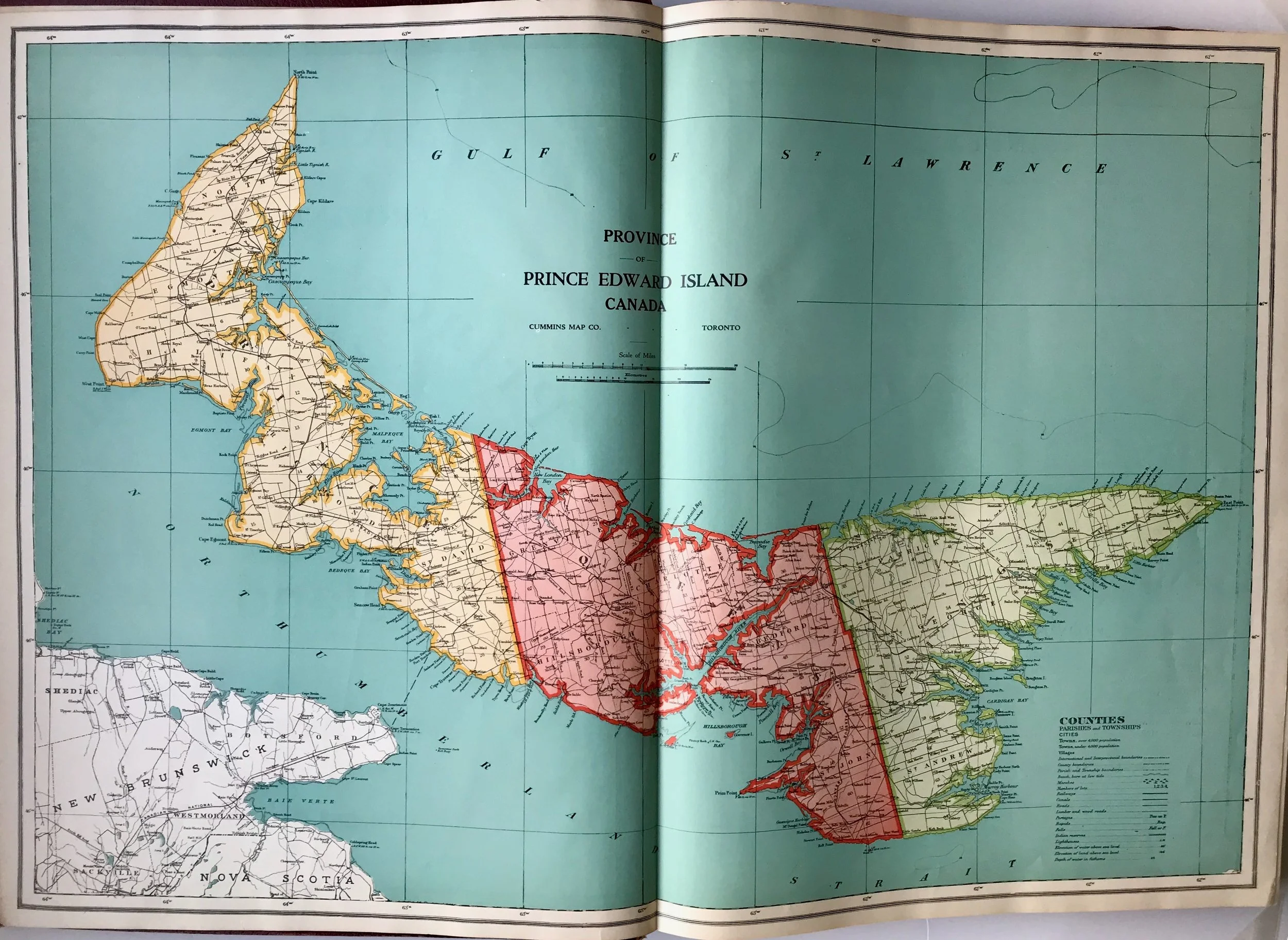
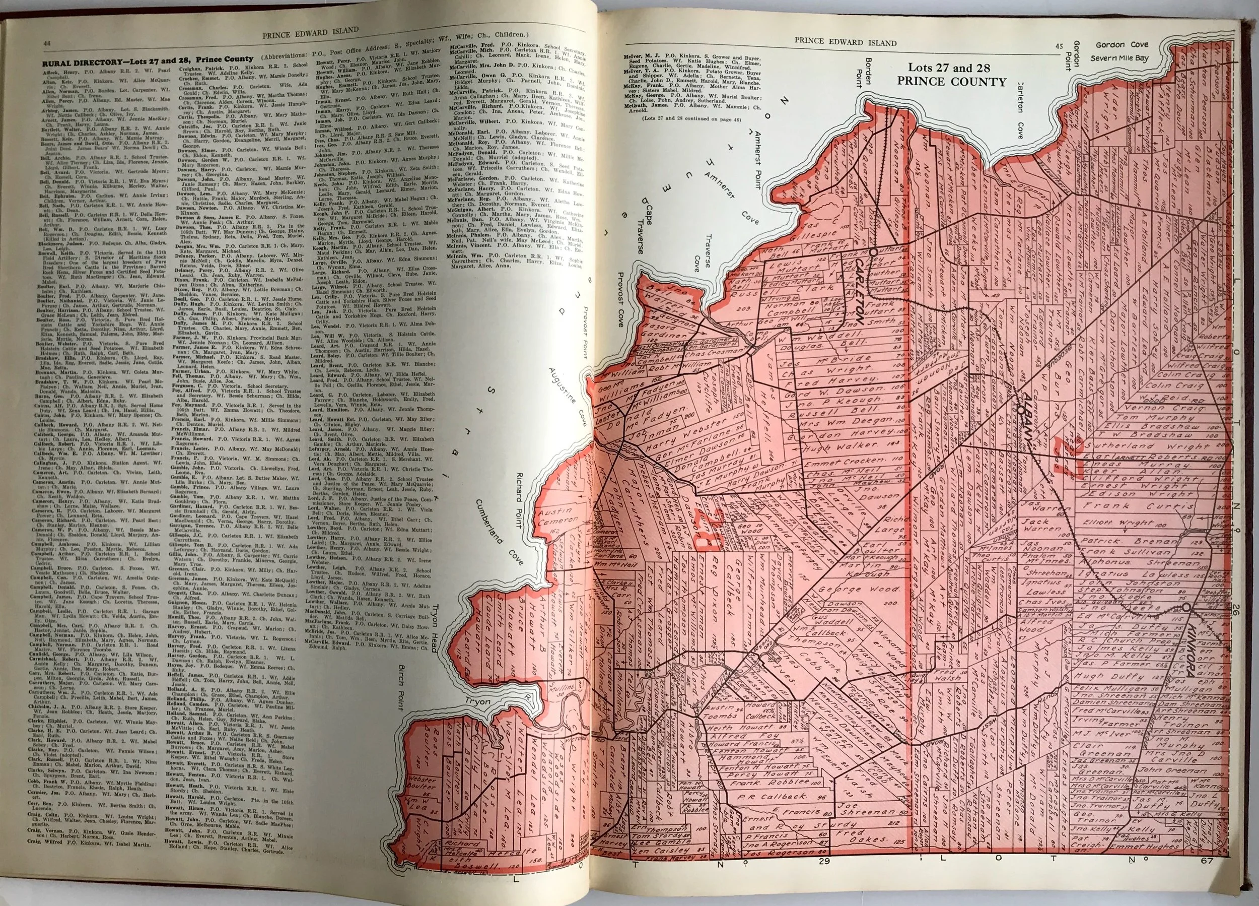
Description: [iv], 140, LXXIIpp. Small folio measuring 16 1/4” X 12 1/4” (41.3 X 31.1 cm). Burgundy pebbled cloth boards; triple rule blind stamped border and gilt-stamped title on the front board. Text supported by coloured maps and numerous black and white half-tone photo images. Included is a description of Prince Edward Island; also, a section dealing with P.E.I.’s involvement in WWI (along lists of who served and the Honour Roll); a double-page color map of the island; 67 maps depicting county lots accompanied by a rural residential directory; and 26 pages illustrating the nine Canadian provinces. The last half of the book is devoted to "The New International Atlas of the World" illustrated with maps by Wharton, Burgoyne and Peake.
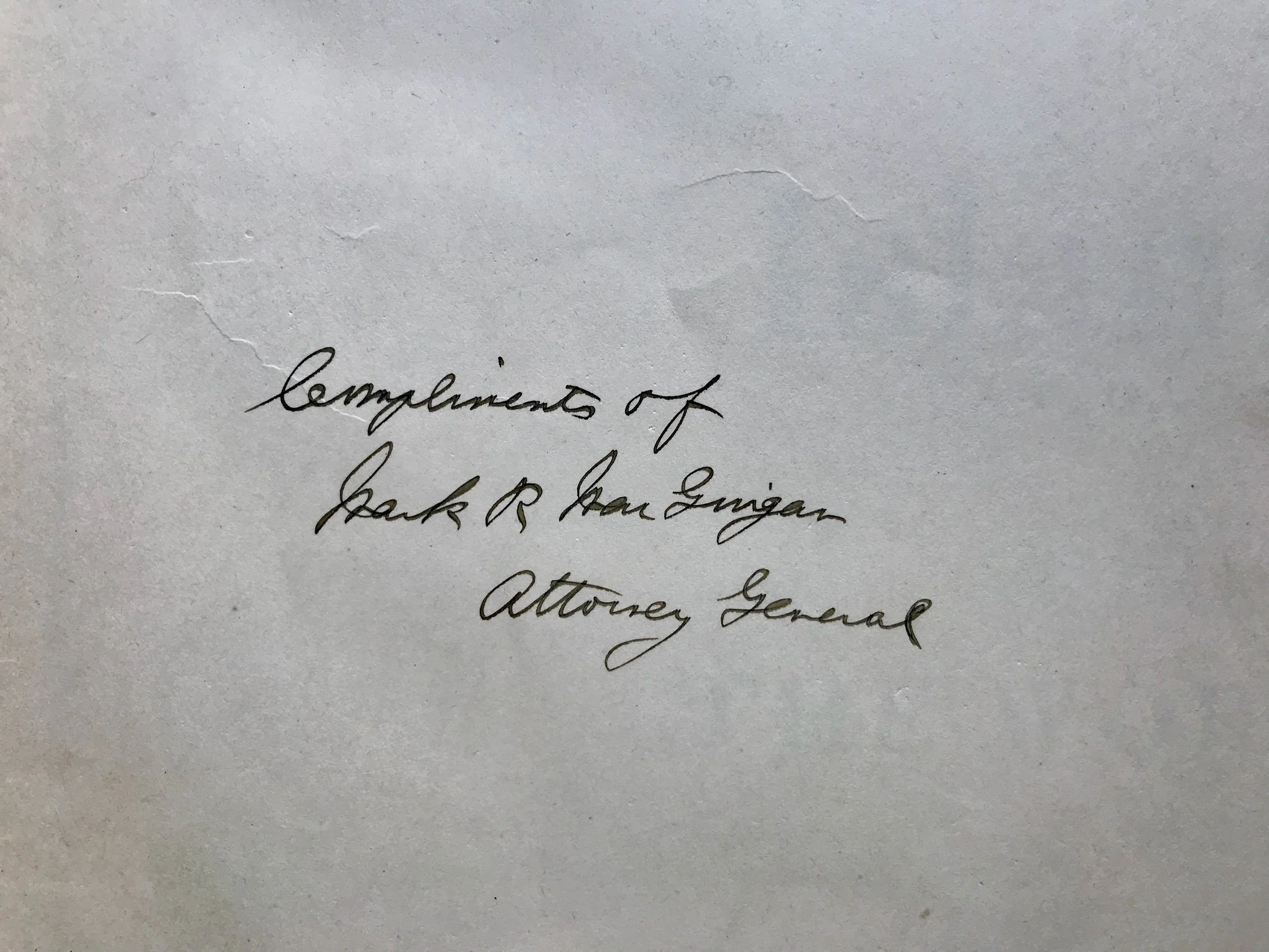
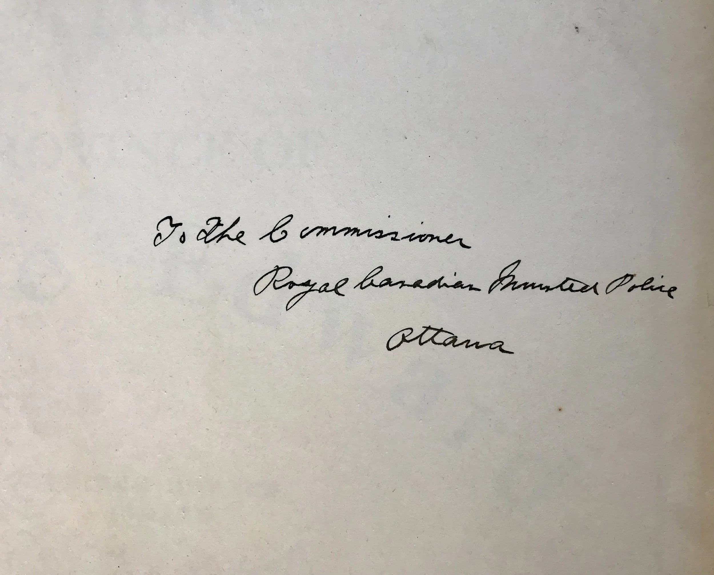
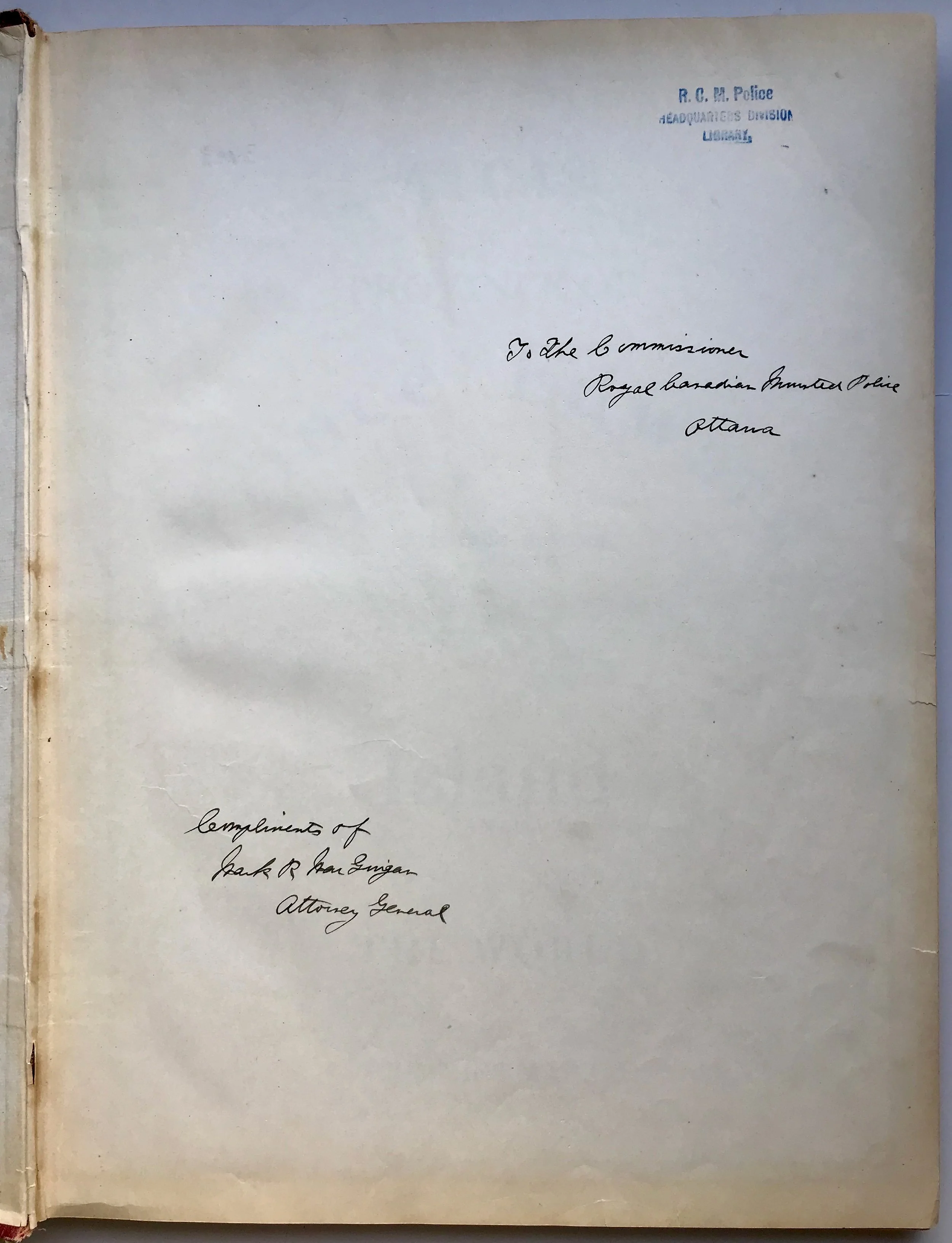
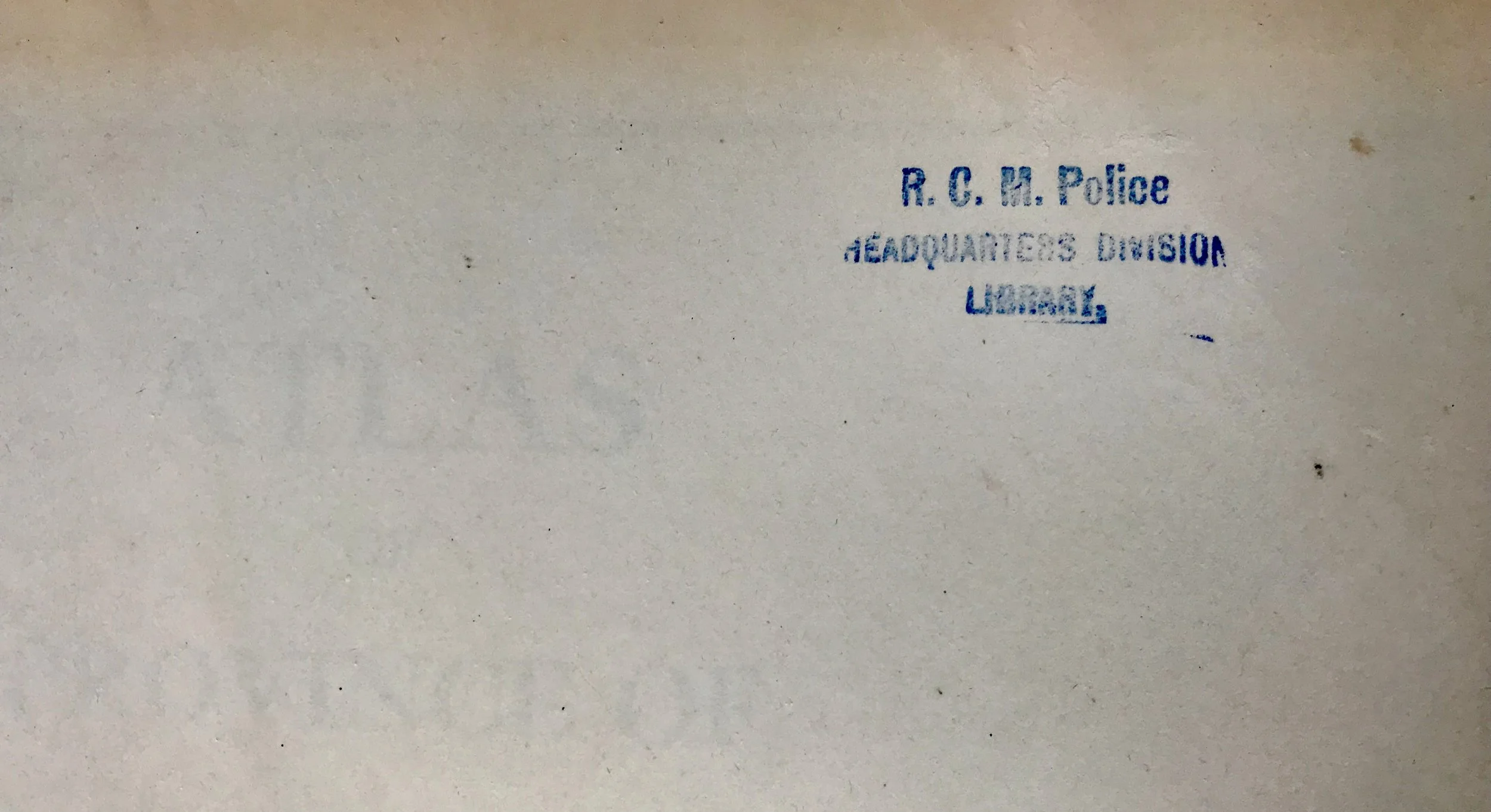
This copy is signed in ink on the front free endpaper by Mark MacGuigan, Attorney General of Canada, and inscribed to the Commissioner of the R.C.M.P. MacGuigan was Attorney General from 1982 to ‘84. During those years, the R.C.M.P. Commissioner was Robert Simmonds.
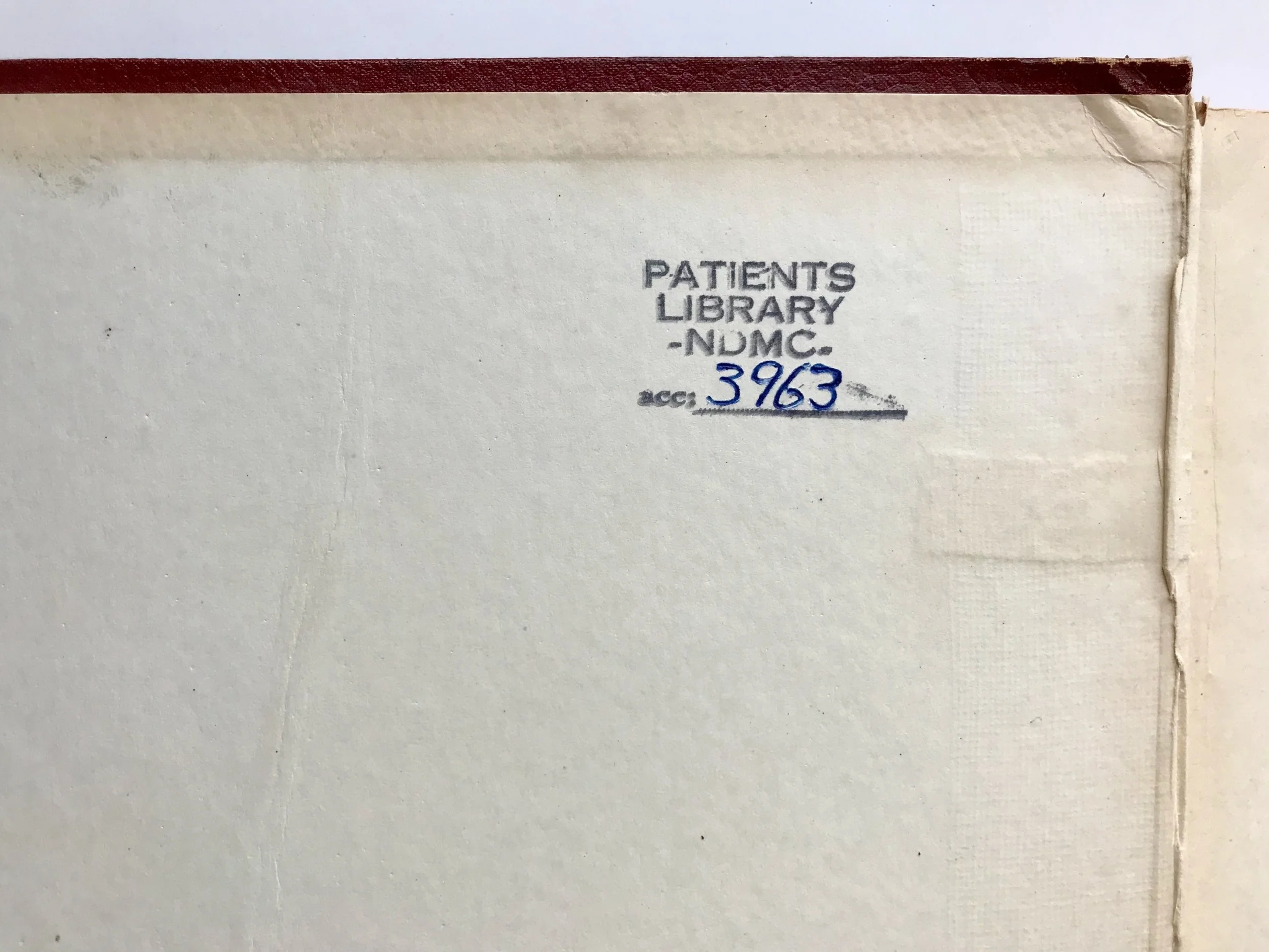
At different times, it appears this atlas was in the library of the R.C.M.P. Headquarters Division Library, and the National Defence Medical Centre (N.D.M.C.) Library in Ottawa. The covers show edge wear. The interior pages are good.
The O.F. Cummins Map Company was established around 1917 in Regina, Saskatchewan. The company's office was located at 12-2350 12th Avenue (Co-operative Elevator Building). The president of the company, Oliver Francis Coumans, was an engineer and land surveyor. He changed his surname to Cummins around 1917, after which the company was known as the Cummins Map Company. Melville S. Arneil, a draftsman, was vice-president and manager. In 1918, Cummins moved to Winnipeg, Manitoba, where he initially operated a branch office of the company out of his home. The Winnipeg office was later located at 904-457 Main Street and 404-160 Princess Street. Arneil maintained the Regina office until around 1920, when he closed that office and moved to Winnipeg. In 1923, Cummins moved to Toronto, Ontario, followed by Arneil in 1924. The company office was located at 70 Lombard Street. Cummins was involved in other work after 1927 but Arneil continued to manage the company until it ceased to operate in the early 1940s.
The main product of the Cummins Map Company was a series of landowner maps, known as the Cummins Rural Directory Maps, for Alberta, Saskatchewan, Manitoba, Ontario and Prince Edward Island. The rural directory maps contained the names and locations of post offices, the location of local rail lines and the names of the owners of each parcel of land within the area covered. The maps were issued as collections of single map sheets instead of being bound in book form as many of the atlases were at the time. The maps were often used by local merchants and travelling salesmen to find customers as well as to assist travellers to find their way across unfamiliar and often unmarked land. The Saskatchewan map series were produced in 1917/1918 (covering most of the settled areas of the province); 1920; 1922; 1926 (covering eastern Saskatchewan) and 1930 (covering north-central Saskatchewan). An uniform sheet numbering system was used and maintained in all series.
Some of the other products produced by the Cummins Map Company included an atlas of Prince Edward Island and Cummins Crop Yield Maps, which indicated the crop yields of the prairie provinces using a "good, fair and poor" rating system. The company also advertised their mounting and drafting services.
Source: Provincial Archives of Saskatchewan
Mark Rudolph MacGuigan (1931–1998), was an academic and Liberal politician. Born in Charlottetown, P.E.I., he was educated at Saint Dunstan’s University (B.A.), the University of Toronto (M.A., Ph.D. (Philosophy)), Osgoode Hall Law School (LL.B.), and Columbia University (LL.M., J.S.D.). He was a professor at Osgoode and U. of T. and was dean of law at the University of Windsor. MacGuigan was first elected to the House of Commons in 1968, winning re-election four times. In 1982, he became Minister of Justice and Attorney General of Canada. MacGuigan retired from politics in 1984 to become a judge on the federal Court of Appeal.
Source: Wikipedia
Robert Henry Simmonds served as Commissioner of the R.C.M.P from September 1, 1997, through August 31, 1987.
Source: Royal Canadian Mounted Police